Pennsylvania Travel Routes Explained
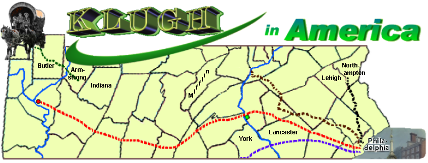
The map at the top of each page was made in a series of steps. First I found a map of Pennsylvania counties. Each county was labeled.
I then removed all the county names except for the four shown, afterwhich I removed the top half of the state.
The early trails are taken from "Map Guide to American Migration Routes, 1735-1815", by William Dollarhide, and published by Heritage Quest in 1997 and which I hand-drew into the map. The map was originally white but I added the light yellow color.
Then I transferred the map image to a graphics creator program and added the name. The images of the buildings in Philadelphia (which I merged together) and pioneers and wagon are all free clipart images.
The trails are as follows:

As the Butler Klughs are in the western portion of Pennsylvania, they most likely followed Forbes' Road as they made their way from Lancaster County to western PA. This means they probably traveled (from east to west) through the following counties: Lebanon, Dauphin, Cumberland, Franklin, Fulton, Bedford, Somerset, Westmoreland, and Alleghany counties. From Alleghany County they then migrated up to Indiana, Butler, Armstrong, Clarion, and Venango counties. The reason it's important to know this is that it may prove crucial to our genealogical research, as any evidence of their presence may still be in these counties.
(c) July 4, 2011: (All rights reserved)